
Antarctica’s “Doomsday Glacier” could raise sea levels twice as much as predicted
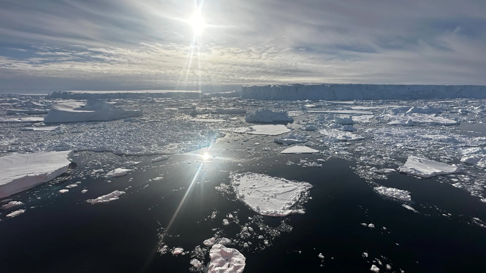
A new computer model suggests that Antarctica's Thwaites Glacier, often called the "Doomsday Glacier," could contribute far more to rising sea levels than scientists previously estimated. Developed by researchers at the University of California, Irvine, and NASA's Jet Propulsion Laboratory, the model predicts that melting from the massive West Antarctic glacier could raise global sea levels by as much as 30 millimeters by 2100. That is double earlier projections, even without any additional warming of the climate.
The findings, published in Nature Communications, reveal why earlier models may have underestimated the glacier's retreat. Instead of treating the boundary between grounded and floating ice as a narrow line, researchers accounted for a much broader area where ocean water can reach beneath the glacier. With this change, the model reproduced historical changes in Thwaites from the 1990s to the present that were four times more pronounced than those represented by conventional models.
Warm Ocean Water Is Melting Antarctica's Ice From Below
"Glaciologists have long based their assumptions of ice sheet dynamics on the 'grounding line,' a discreet, narrow and mostly stable demarcation where ice leaves the land and begins floating on water," said lead author Mattia Poinelli, who was a UC Irvine postdoctoral scholar in Earth system science when the research was conducted. "We have come to acknowledge a different arrangement beneath Earth's major ocean-terminating glaciers. Satellite observations demonstrate the existence of a 'grounding zone,' sometimes kilometers wide, where warm ocean water is reaching deep underneath the ice sheets and causing vigorous melting."
Thwaites Glacier lies in West Antarctica's Amundsen Sea Embayment, a region responsible for approximately one third of the Antarctic Ice Sheet's total mass loss. Over recent decades, the glacier has become thinner and retreated rapidly. Scientists have also observed its ice flowing increasingly quickly, but traditional computer models have struggled to reproduce the acceleration detected by satellites.
To investigate the discrepancy, the UC Irvine-led research team compared its simulations with more than two decades of observations. The researchers also analyzed synthetic aperture radar measurements collected by Finland's ICEYE satellite constellation, which revealed fluctuations extending across several kilometers of the grounding zone along the glacier's main trunk.
The satellite evidence shows that seawater travels several kilometers beneath ice that remains grounded on the seafloor. As tides rise and fall, the water lifts the ice and repeatedly exposes its underside to warm, pressurized seawater. The water reaches Antarctica's coastline through ocean currents that have been altered by climate change, creating conditions that accelerate melting beneath the glacier.
Thwaites Glacier Could Lose a Critical Underwater Anchor
The consequences extend beyond the melting itself. According to Poinelli, who is also a NASA JPL research affiliate and now works as a project scientist at UCLA, the movement of water beneath Thwaites is weakening its connection to underwater ridges that help keep the glacier in place. As these natural supports lose their grip, the ice can flow faster, and the glacier can retreat more rapidly.
"The Thwaites main trunk is being temporarily stabilized by the Mouginot Ridge," he said. "Once that ridge is unpinned, the glacier will continually retreat across a predominantly retrograde seafloor toward its next topographic high, the South Ridge."
The team's simulations suggest that this critical change could happen before 2100. When the model includes a grounding zone measuring 4 to 6 kilometers across, it predicts a 60% probability that Thwaites will become detached from Mouginot Ridge by the end of the century.
"When you factor in key physical processes and calibrate against historical observations, you gain a reliable pathway for narrowing uncertainty in projections," Poinelli said.
New Model Points to Greater Coastal Flooding Risks
The updated projections suggest that scientists may have underestimated the contribution Thwaites Glacier will make to future sea level rise. By more accurately representing how warm ocean water interacts with the underside of the ice, the new model produces results that better match the glacier's observed changes and indicate substantially greater ice loss ahead.
"We have documented and quantified the impacts of climate change on our planet's sensitive ice sheets for decades, but a mounting realization gained in recent years of what is happening on the undersides of glaciers like Thwaites is leading to an even greater sense of alarm," said co-author Eric Rignot, UC Irvine professor of Earth system science. "Most projections up to the present have struggled to match the rapidity of the mass loss because of missing physics; our new model with more complete physics is able to match the record and then produces projections that are twice as large as before. These results predict greater risk of and exposure for coastal flooding than anticipated in the coming decades."
Comments 0
Leave a Reply
Your email address will not be published. Required fields are marked *
Science
Explore All
Scientists discover a hidden reason why muscles weaken with age
Scientists have uncovered a hidden defense mechanism in aging muscles that sacrifices strength to protect cells from damage. In mice, partially restor...

A single sauna session sends immune cells surging through your body
3 hours ago
Smaller EV batteries, longer range? Scientists may have found a way
3 hours ago
Scientists discover a secret glow in toxic fire salamanders
3 hours agoScientists discover a hidden 100-million-year-old volcanic system
3 hours agoWhats New
View All
Oscar Contender ‘Shame and Money’ Acquired in North America by Oscilloscope (EXCLUSIVE)

Meta has a new AI pet app called Waddle World
Thune calls Ohio race 'ground zero' in 'knife fight' for Senate while rallying with Husted

Spanish football postpones 24 Copa del Rey games after train crash

Iraqi PM Ali al-Zaidi meets Ahmed al-Sharaa in historic Syria visit

Nintendo Indie World October 2026 Showcase: All The Biggest Announcements

Free Fire returns to India as Garena launches localized version four years after ban

Jennifer Lawrence Says Playing Katniss Again After 11 Years in ‘Hunger Games: Sunrise on the Reaping’ Was ‘Crazy,’ ‘Unbelievable’ and ‘So Beautiful’

Celebrate Halloween By Getting Five Spooky Mystery Games For Under $7
